Autonomous Aerial Survey Platform
Overview
Traditional infrastructure monitoring and topographic mapping represent labor-intensive, hazardous, and capital-heavy tasks. In developing nations, the steep licensing costs of commercial flight planners, data post-processing suites, and proprietary hardware architectures often lead to safety surveys being neglected or omitted entirely, introducing severe risks of structural failures and preventable accidents.
The Autonomous Aerial Survey Platform (AASP) addresses this research gap by developing a self-contained, low-cost drone surveying platform utilizing commercial off-the-shelf (COTS) components and free/open-source software (FOSS) toolchains. The system is designed to autonomously execute dynamic flight path patterns, perform real-time optical capture, and leverage edge-optimized computer vision networks to identify and map infrastructure faults (such as road potholes, concrete cracks, metal corrosion, and high-voltage insulator damage) under Visual Meteorological Conditions (VMC).
| Project Type | Final Year Design Project (FYDP) |
| Target Application | Infrastructure inspection, disaster response, environmental monitoring |
| Primary Hardware | Raspberry Pi 4B · ESP32 · Pixhawk 2.4.8 · Sony IMX219 (NoIR/RGB) |
| Software Ecosystem | Python · OpenCV · TensorFlow · Ultralytics YOLO · TileServer GL |
| Budget Profile | ~53,500 BDT (highly optimized vs. proprietary platforms) |
Design Approaches
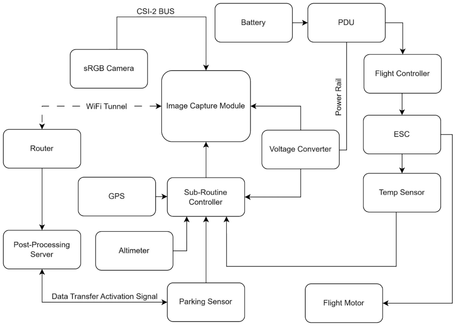
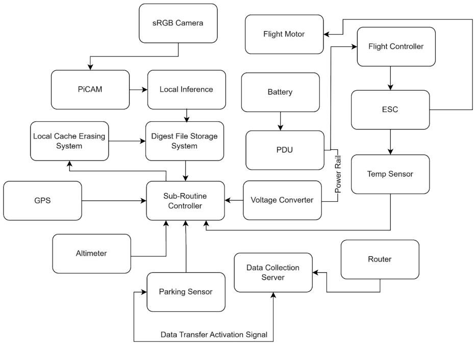
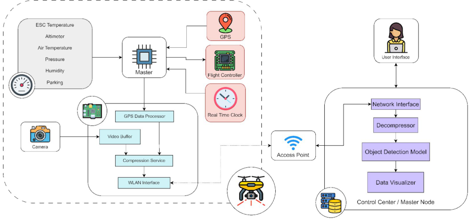
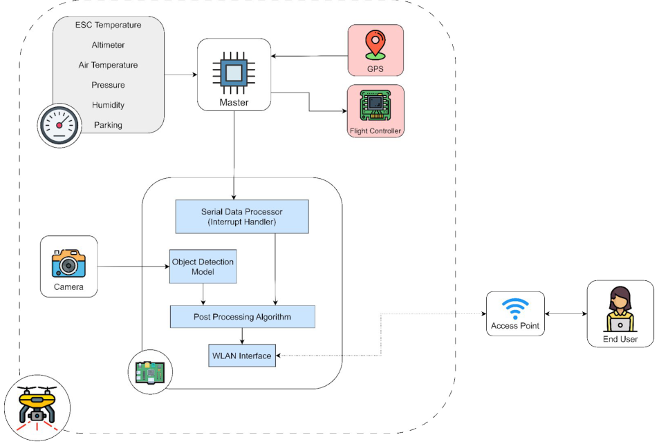
To identify the optimal trade-off between power, weight, data security, and latency, the technical team evaluated two complementary system architectures under identical simulated mission envelopes:
- Design Approach 1 (Self-Contained Edge Inference): Integrates data capture and deep learning inference directly on the drone’s embedded system (Broadcom SoC/NPU). As the drone navigates a preloaded path, real-time object detection model crops the image buffers. When a fault is detected with high confidence, the coordinates are fetched from the GPS and appended to a local CSV file. Post-flight, the drone connects to a secure landing-pad LAN to offload only the light text-based telemetry digest.
- Advantages: Real-time localization, zero network-connectivity dependence in flight, high data privacy (OPSEC).
- Disadvantages: Elevated on-board power draw (~15W compute), requires active heatsink cooling.
- Design Approach 2 (Base-Station Offloading): The drone acts solely as a data acquisition node, capturing sRGB and Near-IR streams to local high-speed storage. Upon landing, the drone establishes an opportunistic Wi-Fi tunnel to a localized ground station server (which runs advanced GPU-accelerated networks) to offload the raw data for processing and buffer wiping.
- Advantages: Lighter payload, lower on-board power draw, permits larger models (e.g., YOLOv12s, Transformers).
- Disadvantages: High transfer latency, relies on stable post-flight connection, high storage write-cycles.
| Differentiating Criteria | Design Approach 1 (Edge Inference) | Design Approach 2 (Base Offload) |
|---|---|---|
| Processing Location | Embedded SoC/NPU on drone | Local Ground Station Server (x86_64) |
| Average Training Time | 11,524.77 minutes (on-device simulation) | 90.16 minutes (GPU workstation) |
| Inference Frame Rate | 2.18 FPS (Raspberry Pi 4B) | 296.67 FPS (Workstation) |
| Inference Efficiency | 0.17 frames/Watt | 2.38 frames/Watt |
| Data Security | Local telemetry digest, immediate buffer wipe | Encrypted buffer transfer via secure tunnel |
| Final Scoring Metric | 8 / 12 (Selected Optimal Solution) | 5 / 12 |
Hardware Components
The airframe and payload subsystems were selected to balance mechanical durability and electronic modularity. Full carbon fiber structural components minimize parasitic weight, maximizing flight time on a 4S LiPo power configuration.
| Component | Model Selection | Key Technical Specifications |
|---|---|---|
| Compute Platform | Raspberry Pi 4 Model B | Broadcom BCM2711, Quad-core Cortex-A72 @ 1.5GHz, 4GB LPDDR4, 15W TDP, 28nm CMOS |
| Flight Controller | Pixhawk 2.4.8 | 32-bit STM32F427 Cortex-M4 @ 168MHz, LSM303D IMU, MS5611 Barometer, MAVLink support |
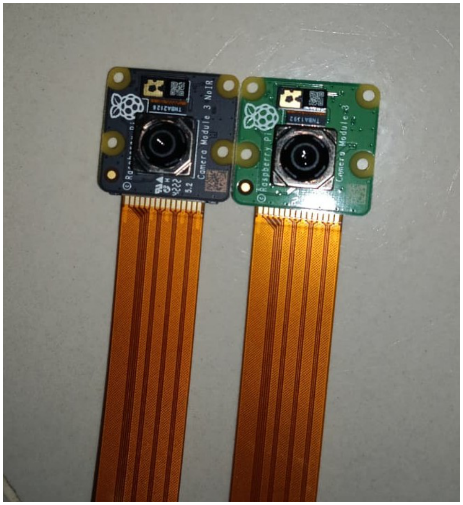
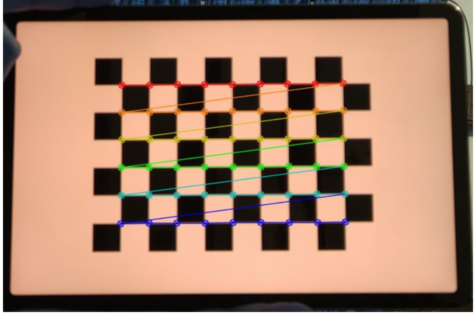
| Camera Sensor | Raspberry Pi Camera V2 | 8MP Sony IMX219PQ, Back-Illuminated CMOS, NoIR and sRGB variants, 1080p @ 30fps |
| Navigation/Compass | Beitian BN-880 | U-blox M8030-KT GPS/GLONASS/BeiDou receiver, Honeywell HMC5883L I2C triple-axis compass |
| BLDC Motors | T-Motor AS2820 KV880 | 880kV rating, 12N14P configuration, 3-4S support, 626W max power, 136g weight |
| Airframe Frame | LJI X500 | 500mm diagonal wheelbase, 3K full carbon fiber construction, 453g bare frame weight |
| Flight Data Recorder | ESP32 WROOM32 | Xtensa dual-core LX6, 520kB SRAM, logging coordinates/headings to local micro SD over SPI |
Software & Mapping Stack
A primary goal of the AASP software design is full independence from external web-based maps and cloud APIs, protecting sensitive infrastructure locations from remote data exposure:
- Offline GIS Mapping Stack (TileServer GL): Hosted in a Hyper-V Linux guest container. It serves vectorized, multi-layer map tiles of target zones in Bangladesh locally over HTTP on port
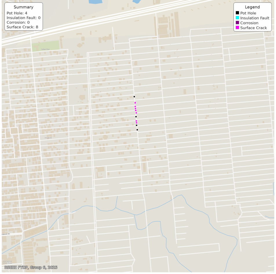
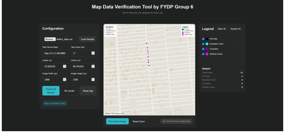
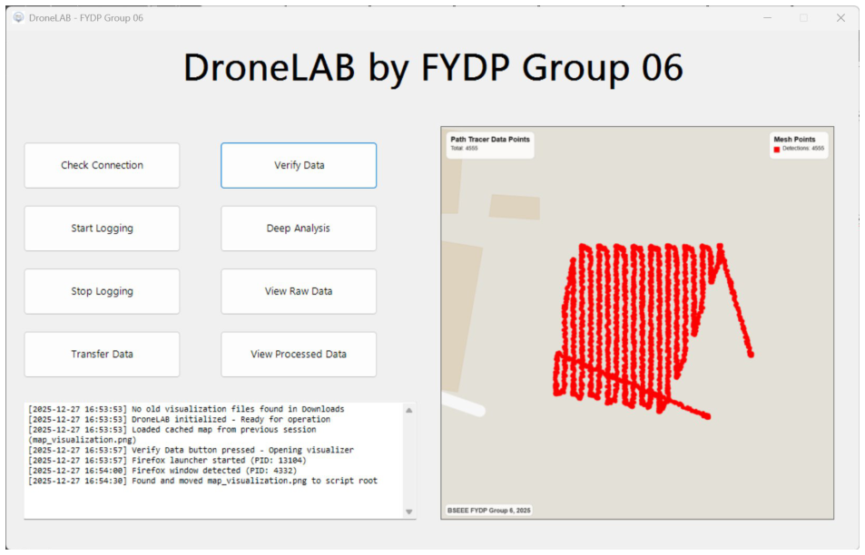
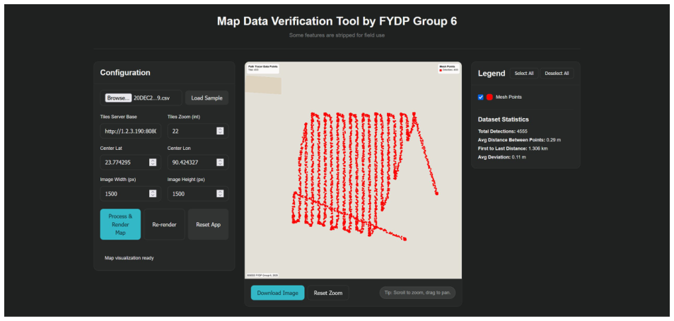
8080using themap_data.mbtilesdatabase. - MapDVT (Data Verification Tool): A custom HTML5/CSS3/JavaScript applet designed to ingest the detection coordinates, calculate exact geodetic vectors, and project them onto the local map canvas using trigonometric formulations.
- MapLAB Deep Explorer: A Python Streamlit and Folium interactive mapping app. It provides local inspectors with a graphical dashboard to filter class faults, preview detection photos, and analyze road-tracing paths.
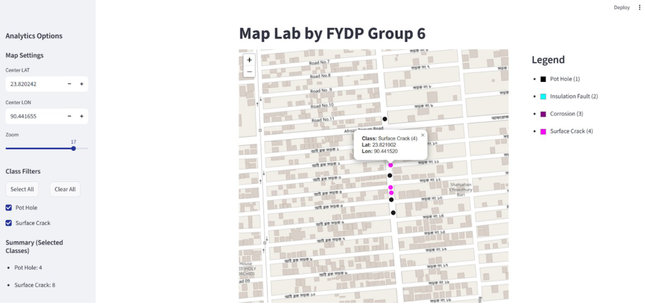
Simulation & Benchmarks
To evaluate deep learning algorithms prior to physical deployment, the team established a simulated Raspberry Pi environment on x86_64 workstation hardware (AMD Ryzen 5 2400G host) by enforcing physical virtualization constraints. Using Linux Cgroups, each guest VM’s CPU performance was throttled by 50% to mirror the 1.8GHz clock speed limits of the ARM Cortex-A72 cores:
$$\text{CPU Quota } \% = \frac{F_p}{F_H} \times 100\% = 50\%$$
Where $F_p$ is the target processor speed ($1.8\text{ GHz}$) and $F_H$ is the host clock speed ($3.6\text{ GHz}$). Additionally, memory bounds were constrained to $8\text{ GB}$ per VM with dynamic memory ballooning drivers to limit host overhead. The overall performance normalization factor was calculated as:
$$\text{Performance Factor } \% = \frac{F_p}{F_H} \times \frac{\text{VM Memory Bandwidth}}{\text{Host Memory Bandwidth}} \times 100\% = 0.5 \times 0.5 \times 100\% = 25\%$$
This verified that the virtualized guest environments operated at approximately one-quarter of the host’s peak performance, providing a highly accurate representation of on-board Raspberry Pi telemetry.
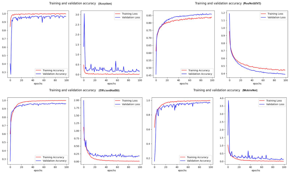
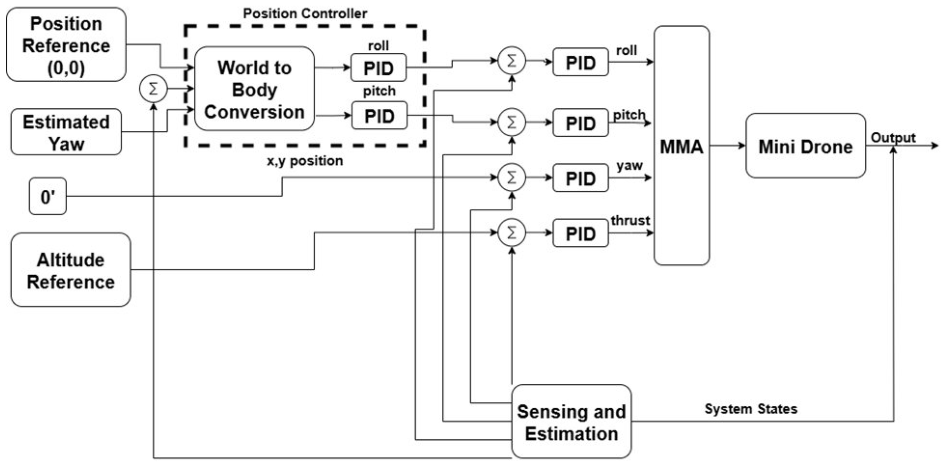
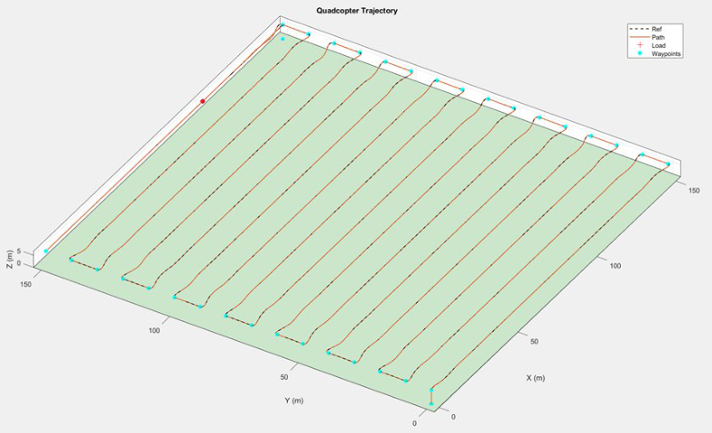
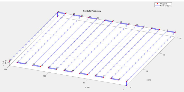
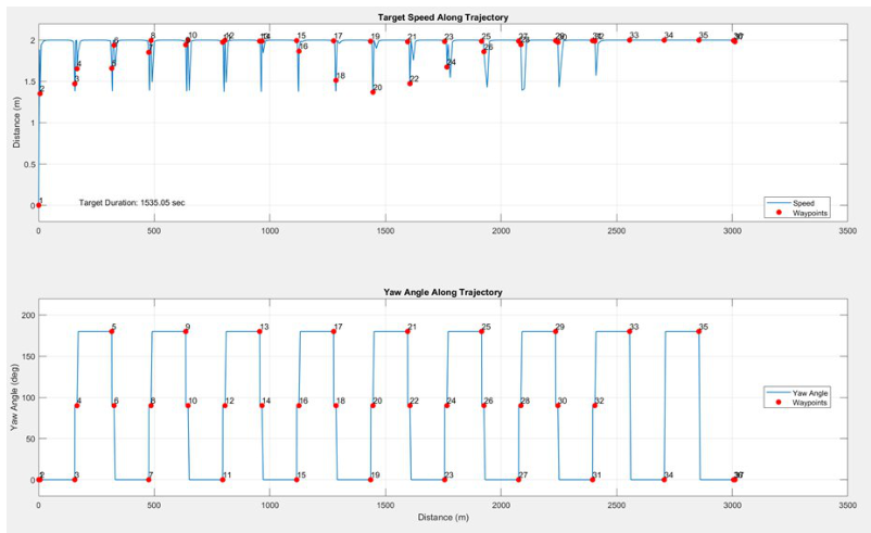
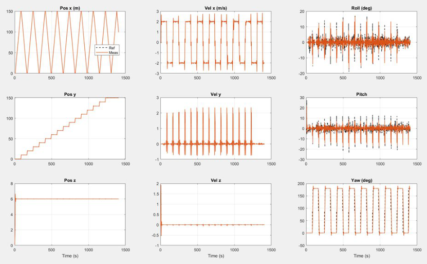
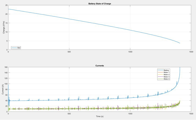
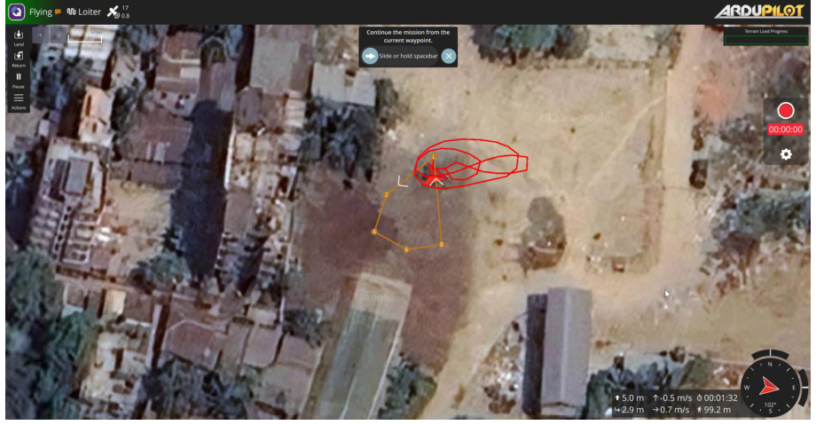
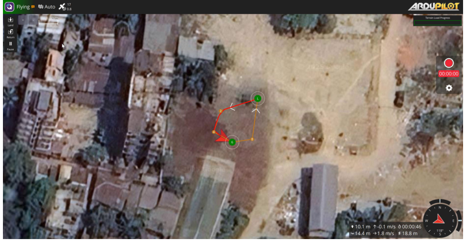
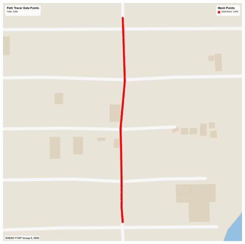
During the flight phase, the quadcopter’s trajectory was evaluated under different density survey patterns to analyze aerodynamic stability, tracking errors, and power discharge profiles. Below are the trajectory tracking sweeps of a medium density zigzag path:
Object Detection & Validation
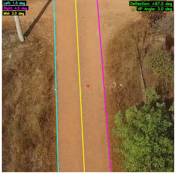
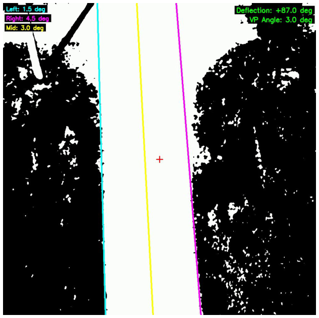
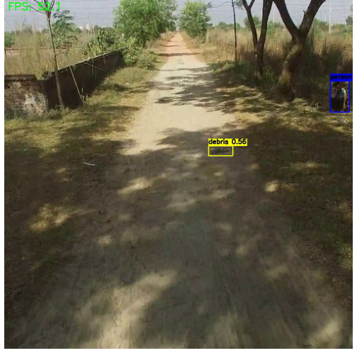
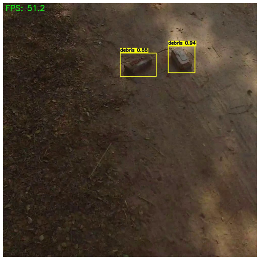
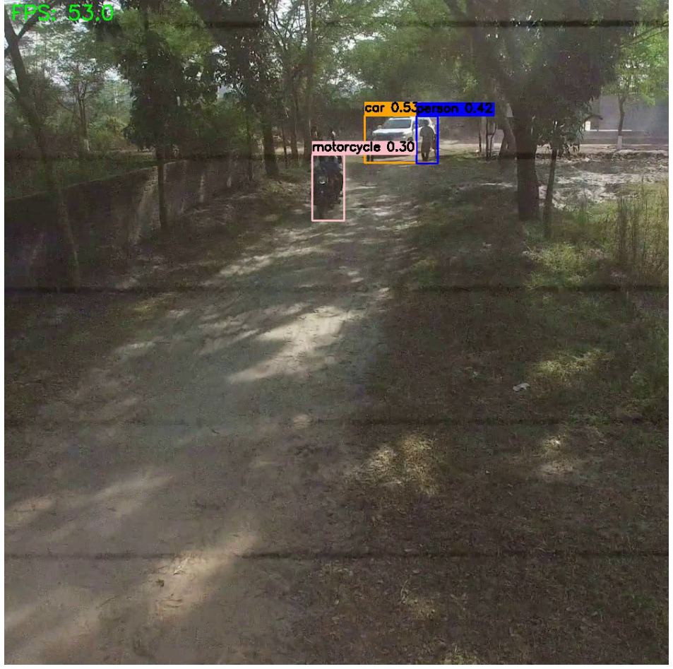
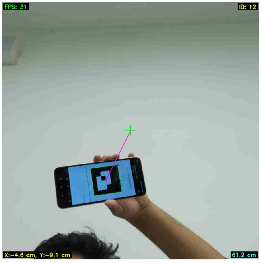
Moving from pure classification to spatial localization, the team curated a dataset of 12,662 high-resolution images split into training, validation, and testing partitions. To eliminate classification noise and count individual infrastructure defects, the team trained multiple object detection models from the Ultralytics YOLO ecosystem (v8n, 11n, 12n, and 12s) targeting four specific fault classes:
- Potholes: Roads surface cavities.
- Concrete Cracks: Structural integrity failures in highway dividers and pillars.
- Metal Corrosion: Oxide damage on bridge girders and transmission towers.
- Insulator Faults: Broken ceramic shells on high-voltage power transmission systems.
A major finding during training was that training YOLO models without early stopping resulted in a sudden drop in precision and validation spikes after approximately 4,000 iterations due to overfitting on similar background frames. By implementing custom early-stopping criteria, the training halted at the optimal plateau, securing robust localization accuracy.
Mitigation & Safety
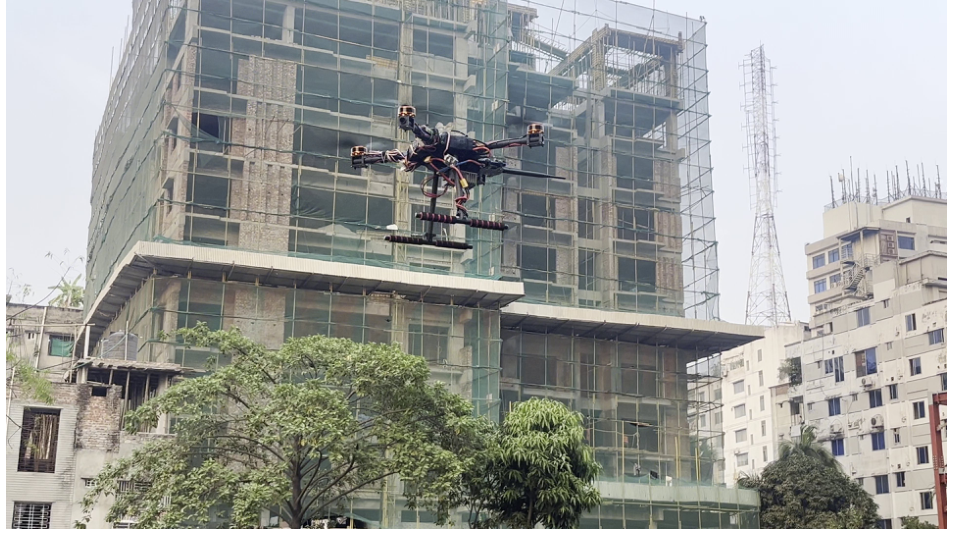
Designing autonomous UAVs for dense urban environments requires strict adherence to international and local airspace safety frameworks. The AASP was built to comply with CAAB (Civil Aviation Authority of Bangladesh) Order No. 30/2020 and EASA/ICAO standards:
- Flight Bounds: Altitude is electronically restricted to a maximum of 200 feet Above Ground Level (AGL), and flight path routing enforces a mandatory 10 Nautical Mile (NM) buffer zone around CAAB aerodromes.
- Weather Safeguards: An integrated base-station weather analyzer blocks autonomous takeoffs if wind speeds exceed 15 knots or if precipitation is detected.
- Emergency Failsafes:
- Mission Failure: An on-board relay isolates the 4S LiPo battery in case of mechanical faults to prevent electrical short-circuits.
- Power Loss: A low-power capacitor backup system triggers an audible buzzer during a sudden crash to alert bystanders.
- Navigation Loss: A safe-parking routine commands an immediate descent or a return-to-base sequence if GPS locks are compromised.
- OPSEC Buffer Wiping: After copying the text-based GPS coordinates to the ground station over an SCP tunnel, the on-board compute module initiates a secure wiping cycle:
This overwrites the imaging cells with random noise in two passes and writes zeros over them, preventing data retrieval in the event of a drone capture.shred -n 2 -z -u *
| Identified Risk Event | Likelihood | Impact Severity | Implemented Mitigation Protocol |
|---|---|---|---|
| Hardware/Propulsion Failure | Medium | High | Dual GPS/Compass redundancy, pre-flight checks, local spare parts sourcing |
| Data Leak / Interception | Medium | High | Air-gapped operation, SCP data transfer, multi-pass on-board shredding |
| GPS Position Drift | High | Medium | On-board manufacturer calibration profile (absolute error limited to 25 cm) |
| Severe Weather Conditions | Low | High | Mini weather station block at takeoff, manual remote disarm radio link |